


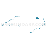
Voting District A3, Hertford County, North Carolina
About
Outline

Summary
| Unique Area Identifier | 640477 |
| Name | Voting District A3 |
| County | Hertford County |
| State | North Carolina |
| Area (square miles) | 9.56 |
| Land Area (square miles) | 9.55 |
| Water Area (square miles) | 0.00 |
| % of Land Area | 99.95 |
| % of Water Area | 0.05 |
| Latitude of the Internal Point | 36.29450880 |
| Longtitude of the Internal Point | -76.93815460 |
Maps


Graphs
Select a template below for downloading or customizing gragh for Voting District A3, Hertford County, North Carolina


Neighbors
Neighoring Voting District (by Name) Neighboring Voting District on the Map
- Voting District A1, Hertford County, NC
- Voting District A2, Hertford County, NC
- Voting District CO, Hertford County, NC
- Voting District HV, Hertford County, NC
Top 10 Neighboring County Subdivision (by Population) Neighboring County Subdivision on the Map
- Ahoskie township, Hertford County, NC (8,620)
- Winton township, Hertford County, NC (4,441)
- Harrellsville township, Hertford County, NC (1,357)